7th parallel south

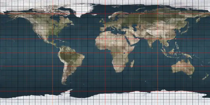
The 7th parallel south is a circle of latitude that is 7 degrees south of the Earth's equatorial plane. It crosses the Atlantic Ocean, Africa, the Indian Ocean, Southeast Asia, Australasia, the Pacific Ocean and South America.

7°
7th parallel south

Part of the border between the Democratic Republic of the Congo and Angola is defined by the parallel.[1]

It is the most populous parallel south of the Equator, being home to between 86.1 million and 99.8 million people as of 2019.[2]

Around the world

Starting at the Prime Meridian and heading eastwards, the parallel 7° south passes through:

Co-ordinates Country, territory or sea Notes
7°0′S 0°0′E Atlantic Ocean
7°0′S 12°50′E Angola
7°0′S 16°58′E Democratic Republic of the Congo
7°0′S 19°32′E Democratic Republic of the Congo / Angola border
7°0′S 20°18′E Angola
7°0′S 20°34′E Democratic Republic of the Congo
7°0′S 29°44′E Lake Tanganyika
7°0′S 30°34′E Tanzania Passing just south of Dar es Salaam
7°0′S 39°33′E Indian Ocean
7°0′S 52°44′E Seychelles Alphonse Atoll
7°0′S 52°46′E Indian Ocean Passing just north of Coëtivy Island, Seychelles
7°0′S 106°33′E Indonesia Island of Java
7°0′S 112°35′E Java Sea
7°0′S 112°46′E Indonesia Island of Madura
7°0′S 114°4′E Java Sea
7°0′S 115°16′E Indonesia Islands of Kangean and Paliat
7°0′S 115°40′E Java Sea Passing just north of the island of Tanahjampea
7°0′S 120°37′E Banda Sea Passing just north of the island of Damar, Indonesia
Passing between the islands of Itain and Maru, Indonesia
7°0′S 131°58′E Indonesia Island of Fordate
7°0′S 131°59′E Arafura Sea Passing just south of the island of Trangan, Indonesia
7°0′S 138°37′E Indonesia Island of New Guinea
7°0′S 141°1′E Papua New Guinea Island of New Guinea
7°0′S 146°59′E Pacific Ocean Solomon Sea
7°0′S 155°42′E Solomon Islands Shortland Island
7°0′S 155°46′E Pacific Ocean Passing just south of Fauro Island, Solomon Islands
7°0′S 156°43′E Solomon Islands Choiseul Island
7°0′S 157°6′E Pacific Ocean Passing between the atolls of Nanumea and Nanumanga, Tuvalu
Passing just north of Niutao island, Tuvalu
Passing south of Starbuck Island, Kiribati
7°0′S 79°47′W Peru
7°0′S 73°46′W Brazil Amazonas
Pará
Tocantins
Maranhão
Piauí
Ceará
Paraíba - passing 6.5 km north of João Pessoa at the mouth of the Paraíba River
7°0′S 34°49′W Atlantic Ocean

See also

References

  1. Brownlie, Ian (1979). African Boundaries: A Legal and Diplomatic Encyclopedia. Institute for International Affairs, Hurst and Co. pp. 489–514.
  2. "World Population Distribution by Latitude and Longitude". Engaging Data. 2019-03-18. Retrieved 2020-08-05.
This article is issued from Wikipedia. The text is licensed under Creative Commons - Attribution - Sharealike. Additional terms may apply for the media files.