Roads in Moldova
Currently, there are three types of public roads in the Republic of Moldova:[1]
- National road (Romanian: Drum național – pl. Drumuri naționale)
- Local road (Romanian: Drum local – pl. Drumuri locale)
- Street (Romanian: Stradă – pl. Străzi)
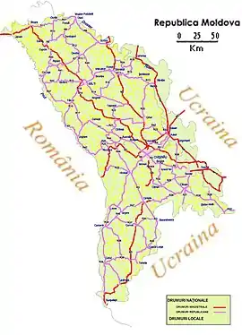
In total, Moldova has a total length of 10,680 kilometres (6,636 mi) of road. From those, 3,668 km (2,279 mi) are national roads and 7,012 km (4,357 mi) are local roads.[2] The general maximum speed limit on public roads is 90 km/h (55 mph), while a speed limit of 50 km/h (30 mph) is imposed inside localities.
Its current road network is inherited from the former Soviet Union (the Moldavian SSR). As one of the poorest countries in Europe, Moldova is the only country which requires use of vignettes (roviniete) on all public roads, inside and outside localities, as a form of road tolling. Vignettes are available for purchase at border crossing points, and drivers caught without a valid vignette are charged with cash fines between €125 and €375.[3]
Motorways
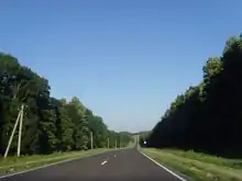
As of 2021, there are no segments of motorway (Romanian: Autostradă) that are officially open. The first motorway-class road in Moldova is planned to be the Chișinău - Cimișlia motorway, which is to be assigned "M3". Works on what could be the first motorway began in the 80s (under Soviet rule), but began to slow down after the dissolution of the Soviet Union in 1991, stopping in 1996 with the Chișinău - Porumbrei segment (32 km or 20 mi) open only on one carriageway. Works on what could eventually become the first motorway in Moldova resumed in 2019.[4]
Thus, it can be said that Moldova has de facto 32 km (20 mi) of motorway in service, but de jure the Chișinău - Porumbrei segment doesn't count as a motorway, with plans calling for the Chișinău - Cimișlia road to receive motorway status only after works are finished.[4]
In 2018, a second motorway route in Moldova (Ungheni - Chișinău - border with Ukraine toward Odessa) was proposed as a continuation of Romania's A8 motorway to the east (est. 100 km or 62 mi long), and thus of the future motorway corridor Iași–Cluj-Napoca–Budapest–Vienna–Munich.[5] In 2021, it had been proposed by the IDEP that the motorway segment between Chișinău and the Romanian border become a "national priority" for Moldova.[6]
National roads
National roads in Moldova are divided into two categories: magistral roads (Romanian: Drumuri magistrale) and republican roads (Romanian: Drumuri republicane).[1] Magistral roads mainly serve as connections to road networks of neighboring countries, those of Romania and Ukraine. Republican roads serve as connections between places in Moldova, but may also reach the border.[1] All magistral roads start or pass through the capital city of Chișinău, with the exception of the M4.[7]
M1 highway
.jpg.webp)
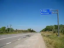
The M1 links Chișinău to the Romanian capital of Bucharest and further Romanian cities via the Leușeni-Albița border checkpoint. It is 97 km (60 mi) long.[7]
M2 highway
The M2 is one of the magistral roads that link Chișinău to the border with Ukraine. The road, which is 185 km (115 mi) long, passes through Orhei and Soroca before reaching the border at Cosăuți. There's no bridge over the Dniester river in the area, however this gap is covered by a ferry.
M3 highway
The M3 serves as a connection between Chișinău and the Moldova–Romania border; this time towards the proposed Lower Danube metropolitan area (which includes the Romanian cities of Galați and Brăila) via the autonomous territory of Gagauzia. The main cities crossed by the road include Cimișlia, Comrat and Vulcănești, ending near the tripoint of Moldova and its two surrounding countries at Giurgiulești. It is 217 km (135 mi) long.
Future plans call for the Chișinău - Cimișlia section to become a motorway-class road, the first motorway in Moldova.[4]
M4 highway
The M4 is the only road that doesn't start or pass through Chișinău and of which all segments are in the control of the Transnistrian government. The road forms the backbone of the Transnistrian road network as it links all the main cities located in the territory: Tiraspol, Dubăsari and Rîbnița, with its northern terminus at the border with Ukraine. It is 178 km (111 mi) long.
M14 highway
The M14 is the longest Moldovan road, at 370 km (230 mi), crossing Moldova on the north - south reference. It passes through the three most populous Moldovan cities (Chișinău, Bălți and Tiraspol), as well as Edineț.[7]
The designation "M14" dates back to the era of the Soviet Union. The Soviet M14 highway served as a link between the present-day border with Poland at Brest (Byelorussian SSR) and the city of Odessa (Ukrainian SSR) on the Black Sea coast.[8] After the dissolution of the Soviet Union in 1991, the designation of the former M14 was retained on the Moldovan section, while the sections in Ukraine and Belarus have gotten new designations.
M21 highway
The M21 is the second connection between Chișinău and the border with Ukraine. It is the shortest of all magistral roads, at 60 km (37 mi), and passes through Dubăsari.
List
.jpg.webp)
| Number | Route | Length | |
|---|---|---|---|
| km | mi | ||
 M1 M1 |
Chișinău – Leușeni → Romania  |
97 | 60 |
 M2 M2 |
Chișinău – Orhei – Soroca → Ukraine |
155 | 96 |
 M2.1 M2.1 |
 M2 – Cosăuți M2 – Cosăuți |
3.5 | 2.2 |
 M3 M3 |
Chișinău – Cimișlia – Comrat – Vulcănești → Romania |
217 | 135 |
 M3.1 M3.1 |
M3 – Comrat East |
4.3 | 2.7 |
 M4 M4 |
Tiraspol – Dubăsari – Rîbnița – Hristovaia → Ukraine |
178 | 111 |
 M14 M14 |
Ukraine → Edineț – Bălți – Chișinău – Tiraspol → Ukraine |
370 | 230 |
 M21 M21 |
Chișinău – Dubăsari → Ukraine |
60 | 37 |
| Total | 1,085 | 671 | |


Local roads
In Moldova, local roads mainly serve as links between district administrative centers and villages/communes located in the specific district, as well as between one village/commune and another.[1] They are maintained by the appropriate local authorities depending on their location, previously being maintained by the national state-owned company Administrația de Stat a Drumurilor (ASD) until 2017. Since then, the ASD solely maintains national roads, with the exception of those located in Transnistria.[2]
European routes
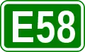
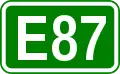
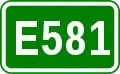
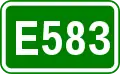
European routes (E-roads) passing through the Republic of Moldova:[7]
- Class A:
- Class B:
Transnistria
As an autonomous territory with limited recognition as an independent state, the authorities of Transnistria, which is internationally recognized as part of Moldova, have complete control of all road segments that pass through the breakaway territory. The M4 highway, which crosses Transnistria on the north–south reference, is in complete control of Transnistria, as well as parts of M14 and M21, and many segments of republican and local roads. The complete length of the Transnistrian road network totals 1,070 km (660 mi).[2]
References
- Roads law no. 509/22.06.1995
- https://www.asd.md/wp-content/uploads/2021/08/raportul_de_implementare_a_programului_privind_repartizarea_mijloacelor_2020.pdf
- "News on road tax in Moldova". Archived from the original on 2013-02-19. Retrieved 2021-06-04.
- "(VIDEO) Drumul care trebuia să fie prima autostradă din Moldova: aşa arată în prezent construcţia porţiunii Porumbrei-Cimişlia". piataauto.md.
- "Autostradă de 100 de km în Moldova! Subiectul a ajuns în agenda Parlamentului European și a Comisiei Europene". autoblog.md.
- "IDEP suggests making Chișinău-Ungheni highway national priority". IPN.
- Google. "Map of Moldovan road network" (Map). Google Maps. Google.
- "Moldova - Road numbering systems". sites.google.com. Retrieved 2022-03-05.
