Saskatchewan Highway 663
Highway 663 is a highway in the Canadian province of Saskatchewan. It runs from Highway 11 to Highway 16. Highway 663 is about 31 km (19 mi.) long and runs along the routing of Range Road 3042.
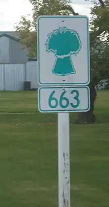
663 signage
  | ||||
|---|---|---|---|---|
| Route information | ||||
| Maintained by Ministry of Highways and Infrastructure & Transport Canada | ||||
| Length | 31 km (19 mi) | |||
| Major junctions | ||||
| West end | .svg.png.webp) Hwy 11 near Dundurn Hwy 11 near Dundurn | |||
.svg.png.webp) Hwy 211 Hwy 211 | ||||
| East end |  Hwy 16 (TCH) near Floral Hwy 16 (TCH) near Floral | |||
| Location | ||||
| Country | Canada | |||
| Province | Saskatchewan | |||
| Highway system | ||||
|
| ||||
| ||||


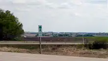
Highway 663 road sign located at Highway 16 or the Yellowhead Highway turn off
Intersections from south to north
| Rural municipality | Location | km | mi | Destinations | Notes |
|---|---|---|---|---|---|
| Dundurn RM | | 0 | 0.0 | Hwy 11 | |
| | 1 | 0.62 | Township Road 330 to Thode | ||
| | 3 | 1.9 | Hwy 211 | ||
| | 5 | 3.1 | Township Road 332 to Shields | ||
| | 8 | 5.0 | Township Road 334 | ||
| | 11 | 6.8 | Township Road 340 | ||
| | 14 | 8.7 | Township Road 342 | ||
| | 17 | 11 | Township Road 344 | ||
| Corman Park RM | | 21 | 13 | Tamke Road (Township Road 350) | |
| | 24 | 15 | Melness Road (Township Road 352) | ||
| | 27 | 17 | Baker Road (Township Road 354) | ||
| | 29 | 18 | Cheviot Road (Township Road 355) | ||
| | 31 | 19 |  Hwy 16 (TCH) / Floral Road (Township Road 360) (end) Hwy 16 (TCH) / Floral Road (Township Road 360) (end) | ||
| | 31 | 19 | Freeborn Road (Range Road 3042) | ||
| 1.000 mi = 1.609 km; 1.000 km = 0.621 mi | |||||
References
This article is issued from Wikipedia. The text is licensed under Creative Commons - Attribution - Sharealike. Additional terms may apply for the media files.